San Marcos Pass Road – Highway 154 – a scenic backroad
The San Marcos Pass Road – Hwy 154
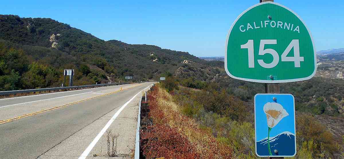
San Marcos Pass Road (California Highway 154 and sometimes known as the Chumash Highway) is a lovely backroad of Highway 101 that has some backroads of its own. A nice way into and out of Central California.
 Highway 154 over San Marcos Pass and into the Santa Ynez Valley
When considering to take a backroad or not, the choice is usually fairly simple – take the faster main highway or the slower but more scenic route?
Here, the choice isn’t so clear – shall we take the scenic 101 and stay by the ocean or take the scenic inland route?
If you are coming from Southern California and heading to the Santa Ynez Valley, taking the Chumash Highway is the obvious choice. However, if you are going further north into Central California, either way is a good route. Highway 154 is about 10 miles shorter than taking Highway 101, but not quite as fast.
 Vista of Santa Barbara and Santa Cruz Island from Painted Cave Road just off Highway 154
This photo might determine your choice for Highway 154. Being up about 2000′ always gives some wonderful views. And once over the pass on the northern side, there are lovely views of Lake Cachuma and the valley below.
The 154 also gives you access to some interesting side trips, such as the Chumash Painted Cave, the Cold Spring Tavern, Lake Cachuma and an easy way to Foxen Canyon wineries.
 The Cold Spring Tavern on Stagecoach Road
How to get to Highway 154

From the Santa Barbara area, take exit 101B for State St. either from North or Southbound Hwy. 101.
At the northern end – take exit 146 off the 101 and since this is the inception of the road there is only one way to take the 154.
Some of the sights along San Marcos Pass Road
 Highway 154 above Santa Barbara

View of the Santa Ynez Valley with Lake Cachuma

View of the Cold Spring Arch Bridge from Stagecoach Road
The Cold Spring Bridge is quite a work of engineering and fascinating to see from underneath. Highway 154 passes over it.

Lake Cachuma
This photo was taken from a rest area of sorts by the Lake Cachuma dam. Lake Cachuma is formed from the waters of the drainage of the Santa Ynez River. There are recreational activities here as well as camping.

Springtime in the Santa Ynez Valley – lupines among the oaks
This season is always one of great beauty in Central California. Backroads are great for wonderful displays of wildflowers.

Santa Ynez Valley Wine Country

Downtown Los Olivos
The Featured Image on the top of the page is courtesy of Niranjan Arminius and is licensed via https://creativecommons.org/licenses/by-sa/4.0/deed.en